Waterproof Charts 40 Lake Ponchartrain to Gulfport Standard
Bestseller
- Product Code:
- 131899233
For partners
Log in to see the price
Properties
- Unit Quantity
- 1
Other features
- Бренд
- Waterproof Charts
Weight & dimensions
- Вес
- 0.227 kg
Логистические данные
- UPC
- 740399004004
Общие характеристики
- MPN
- 40
Свойства
- Пол
- Женский, Мужской
Description
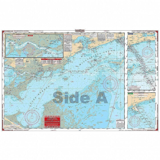
Waterproof Charts 40 Lake Ponchartrain to Gulfport Standard
Complete coverage of Lake Ponchartrain and Lake Maurepas, through Chef Menteur Pass and the intracoastal waterway to the Rigolets and Lake Borgne. Includes Mississippi Sound and the Ship Island Area. Details for Gulfport and the Rigolets as well as the Inner Harbor Navigation Canal in New Orleans. This Lake Pontchartrain map is full of bright colors and tons of detail thanks to information from 6 different NOAA charts. This navigation chart has complete coverage of Lake Pontchartrain and Lake Maurepas, through Chef Menteur Pass and the intracoastal waterway to the Rigolets and Lake Borgne. It also includes Mississippi Sound and the Ship Island Area. Details for Gulfport MS and the Rigolets as well as the Inner Harbor Navigation Canal in New Orleans.
