Waterproof Charts 98 Charleston Harbor to Myrtle Beach Standard
Bestseller
- Product Code:
- 131899222
For partners
Log in to see the price
Properties
- Unit Quantity
- 1
Other features
- Бренд
- Waterproof Charts
Weight & dimensions
- Вес
- 0.142 kg
Логистические данные
- UPC
- 740399009801
Общие характеристики
- MPN
- 98
Свойства
- Пол
- Женский, Мужской
Description
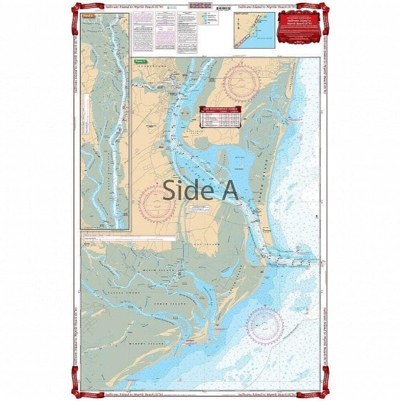
Waterproof Charts 98 Charleston Harbor to Myrtle Beach Standard
An excellent combination of two government charts makes for easy use. Starting at Sullivans Island, this chart provides complete coverage of the Intracoastal Waterway through Winyah Bay and Georgetown, north to mile maker 365 at Myrtle Beach. Also includes an inset for Murrell’s Inlet. Complete coverage for Winyah Bay and the entrances for the north and south Santee Rivers. This chart provides much more information than the Intracoastal Waterway chart alone! Take one look at this Myrtle Beach map and you will need no convincing. The vibrant colors and intense amount of detail make this the best navigation chart for the area. An excellent combination of two NOAA charts makes for easy use. Starting at Sullivans Island, this nautical map provides complete coverage of the Intracoastal Waterway through Winyah Bay and Georgetown, north to mile marker 365 at Myrtle Beach. Also includes an inset for Murrell’s Inlet. There is complete coverage for Winyah Bay and the entrances for the north and south Santee Rivers. This marine map provides much more information than the Intracoastal Waterway map alone!
